
4WD Track Classification Chart
Current Track Classification Chart
This chart was developed because we felt that the current Track Classifications by Four Wheel Drive Victoria are outdated and do not account for advancements in technology and the vast range of off-road vehicles available today. The existing system aims to categorise off-road 4WD tracks from easy to very difficult, but it lacks information about the track’s terrain and what drivers can expect. This approach is unreliable, especially for enthusiasts seeking new tracks and specific indicators. In our 4WD experience, we have often found discrepancies between HEMA’s categorisation and the actual difficulty of the tracks we encountered, leading us on tracks that don’t align with the listed track difficulty.
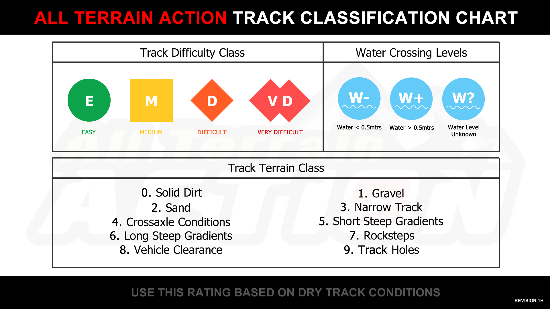
Understanding classification symbol & text.

The combination of track difficulty class with track terrain class will provide valuable insights into the level of four-wheel driving you can expect and the types of terrain you might encounter on the named track. Additionally, it offers some information about the last known water level at crossings. The water level crossing symbols can also be used on a map independently to indicate what the crossing point might be like.
The symbols and colors are not necessary to understand the acronym. It is broken down to the first alpha letter(s) to indicate track difficulty class, followed by numeric values to determine the expected terrain classes on the track. The last section indicates if there are any water crossings and whether they are known to be under 0.5 meters ‘w-‘ or over 0.5 meters ‘w+’ in depth. There is also an option to label it as unknown ‘w?’ if needed. We anticipate this format to be the most commonly used on maps, but we expect that the community might use ‘w-‘ or ‘w+’ to indicate their most recent crossing experiences. It’s essential to remember that rainfall in the area affects water depth, so this information serves only as an indicator.

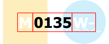
If there is no water crossing on the track at all, then you can omit the crossing symbol and the use of ‘w-‘, ‘w+’, or ‘w?’. This can also be displayed in text or color format as M0135 or M0135.
Similar to the example above this chart can also be used in the following format M0135w- or M0135w-, if you want to be more clear where colors are selected from the chart above and then used without the symbolic nature of the difficulty class. All of this is designed to be used in various methods, some of which are intended for displaying on maps over a track or on a video in a corner, allowing the viewer to understand the track information at any point. The text-based versions, both plain and colored, can be deciphered when used in social media posts or during general text conversations.

All ratings are determined under dry conditions, and the numeric value indicates the expected terrain classes. However, it is important to understand that ‘M0135w-‘ versus ‘D0135w-‘ means that the terrain classes are more aggressive in the more difficult track class. This provides beginners with a good method to progress to more difficult track classes while staying on the type of terrain they prefer.
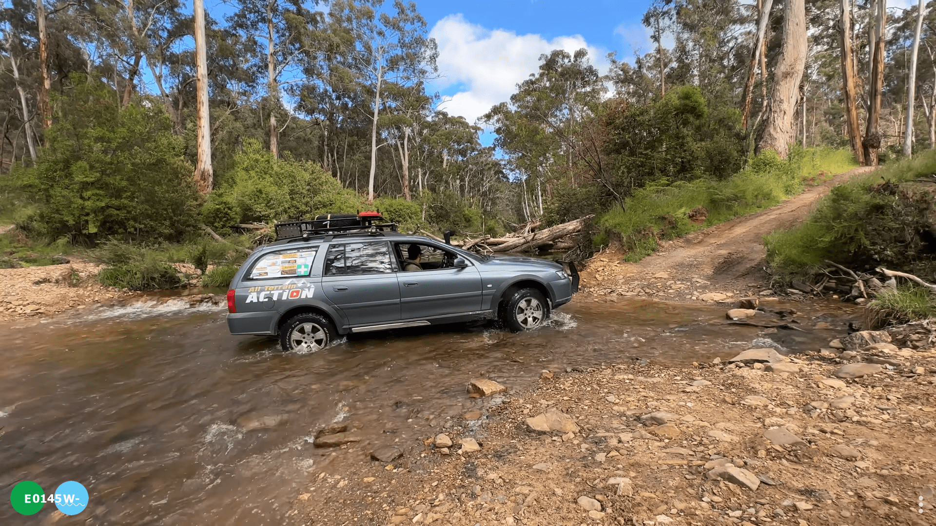
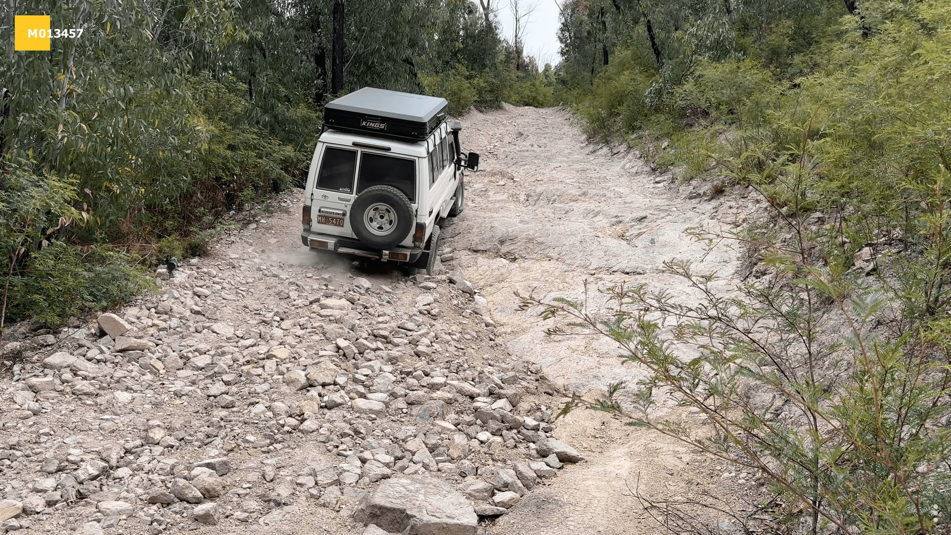
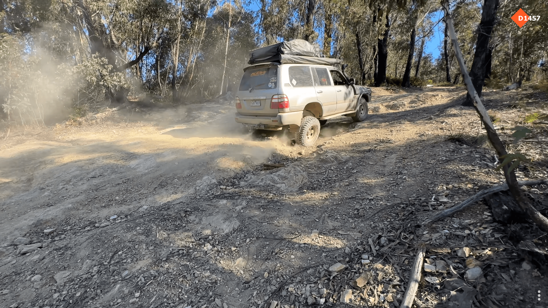
Examples of how these classifications may appear in our future videos.
Additional factors about wet season and track variations due to weather impact.
It is crucial to recognise that in wet conditions, the terrain characteristics of a track can change significantly. Heavy rainfall has the potential to erode solid dirt and gravel surfaces, unveiling rock formations that were previously hidden. Additionally, sand, which is typically soft during dry seasons, might become more compact in wet conditions. Moreover, track holes that are filled with mud during the rainy season could have a solid surface layer while still maintaining soft conditions beneath.
Be mindful and also research recent weather activity in the area you plan to travel to. By doing so, you can make your own judgment on how track classifications may differ as a result. Keep in mind that staying informed about recent weather conditions will allow you to anticipate possible changes in track terrain, enabling you to plan your journey more effectively and ensure your safety and enjoyment.
Use of this track classifications system.
Feel free to utilise this system for personal use without the need for permission. However, if you intend to use it commercially, such as on blogs, websites, or video streaming platforms, we kindly request that you include a link to this page. This link will serve as a reference for those interested in understanding the classification terms and how the system works.
How can I generate the images to place on videos?
You can use this page here and enter in the track code and it will generate a transparent PNG image for you to download/save to your device for placement in your video or image. Permission is not required to use this as long as you link back to this page so your viewers/audience knows how to read and understand the symbol’s usage.
Feedback about this classification system is welcome and can be done using our contact us page.